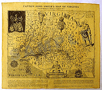
Captain John Smith's Map of Virginia 1612
Captain John Smith landed in Jamestown, Virginia in 1607, and by 1612 he had created this map of the state. Considered one of the most important printed maps of early America, it is intricately drawn and features such early geographic markers as the "Virginia Sea." Document size: 16" x 14" in parchment paper.